
Geographic Information Systems
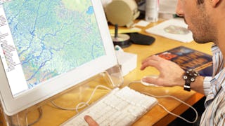
Geographic Information Systems (GIS) is a framework for gathering, managing, and analyzing location-based data and associated attributes. Coursera's GIS catalogue teaches you about the principles and applications of GIS, from creating maps to performing spatial analysis. You'll learn how to leverage GIS technology to visualize, question, analyze, and interpret data to better understand relationships, patterns, and trends in the world around us. You'll also delve into topics like geocoding, remote sensing, spatial statistics, and GIS software tools. These skills will be invaluable in fields such as urban planning, environmental science, transportation, and public health, where understanding the geographic aspect of data is critical.
15credentials
60courses
Most popular
 Status: Free Trial
University of California, Davis
 Status: Free Trial
University of California, Davis
 Status: Free Trial
University of Toronto
 Status: Free Trial
Johns Hopkins University
Trending now
- Status: Free Trial
University of California, Davis
- Status: Free Trial
Johns Hopkins University
- Status: Free Trial
University of Toronto
- Status: Free Trial
University of California, Davis
New releases
 Status: Free Trial
Case Western Reserve University
 Status: Preview
The University of Edinburgh
 Status: Free Trial
Skillshare
 Status: Free Trial
Filter by
SubjectRequired
Required
LanguageRequired
Required
The language used throughout the course, in both instruction and assessments.
Learning ProductRequired
Required
Build job-relevant skills in under 2 hours with hands-on tutorials.
Learn from top instructors with graded assignments, videos, and discussion forums.
Learn a new tool or skill in an interactive, hands-on environment.
Get in-depth knowledge of a subject by completing a series of courses and projects.
LevelRequired
Required
DurationRequired
Required
SubtitlesRequired
Required
EducatorRequired
Required
Results for "geographic information systems"
Sort by: Best Match


